Land registry price paid parish
Download data
We downloaded a CSV file that contained property price data for the past three years, along with the postal code coordinates and boundary line polygons.
$ wget bdline_gpkg_gb.zip
&& unzip bdline_gpkg_gb.zip
&& cd data
Import bdline
We used ogr2ogr to convert a file containing boundary lines (in a format called GeoPackage) into a PostgreSQL file, changed the projection of the data from OSGB1936 to WGS84, and imported it into a database.
ogr2ogr \
-f "PostgreSQL" \
-a_srs "EPSG:27700" \
-t_srs "EPSG:4326" \
-progress PG:"dbname='gis' host='$ip' port='5432' user='$user'
password='$password'" \
bdline_gb.gpkg
Connect to server
Starting a psql instance on the client in order to interact with the database on the server.
psql -h 192.168.88.10 -U postgres gis
Create priced paid polygons for every point
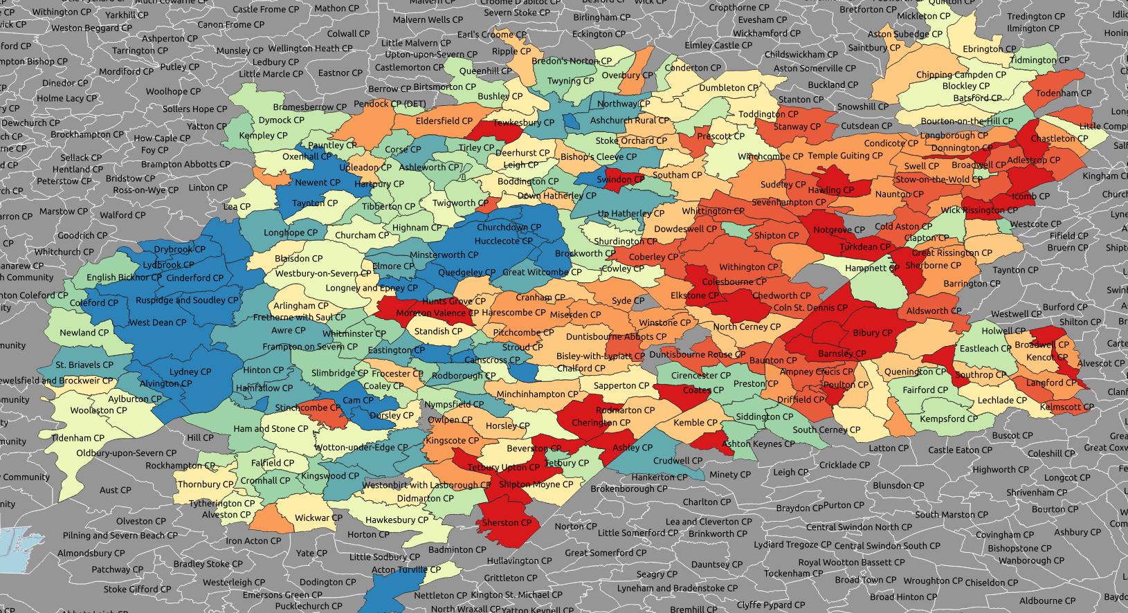
We used point data that was already in the database from a previous project to create a new polygon for each point that was within the boundaries of a parish. We also added the price paid for each house (the point) to the corresponding polygon.
SELECT
parish.geom,
points.pounds
INTO pp_parish
FROM
parish INNER JOIN points
ON st_contains(parish.geom, points.geom);
Find avarage point value for duplicate polygons
Like in the the previous project, we calculated the average value for each of the duplicate polygons.
SELECT geom,avg(pounds)
INTO avg_pp_parish
FROM pp_parish
GROUP BY geom;
Import new price paid polygons to file
Qgis > Database > DB Manager > Import Layer/File - Name: pp_parish
Add price paid polygons layer to Qgis
Qgis > Layer > Add Layer > Add Vector Layer
Qgis > Database > DB Manager > Import Layer/File - Name: pp_parish
Vector Dataset(s): .shp
Colour polygons by attribute field
Right click: Layer > Properties
Symbology > Single Symbol: Gradiated
Vaule: pounds
Colour Ramp: Spectral
Invert Colour Ramp
Segmentation: Equal Interval